VIMS

Assessing My Flooding Risk

From the 1970's inventory of tidal marshes to the thousands of shoreline site visits in the 2000's, CCRM researchers noticed changes in the wetland systems being studied, and worked to figure out why.  More frequent flooding was discovered to be part of the reason for these changes. This research led to several tools to help you understand and reduce your flooding risk; from occasional large weather events to everyday road flooding.

WHAT IS FLOODING?

Flooding is an overflowing of water onto land that is normally dryDepending on the source, the flooding may be predictable, like tidal flooding, or be very unpredictable and vary in frequency, duration and strength, such as rainfall-induced flooding. 

What are the sources of flooding? The most notable forms of flooding come from storm surge, rain, and tides.  Click on an arrow next to a flood variety that you’d like to know more about:

Storm Surge Flooding ...

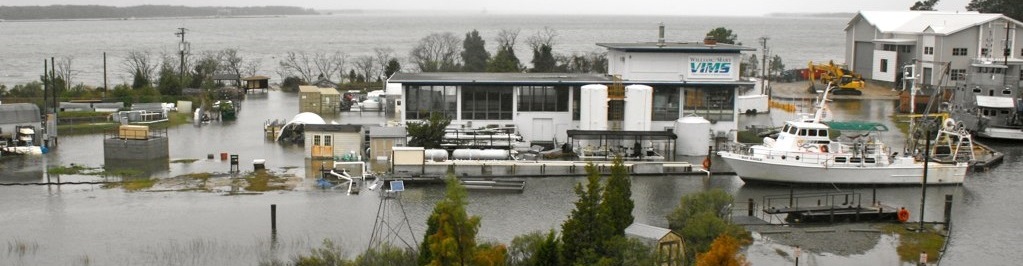
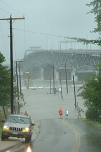
Storm surge is a dangerous wall of water created by the winds of severe storms like hurricanes, tropical storms, and nor’easters.  These storms can cause Bay and ocean water to pile up before pushing it on shore.

Storm surge can affect large areas of coastal lands, but the amount of flooding is different with each storm.  The surge height depends on the direction the storm approaches the coast, as well as the strength, speed and timing of the storm.  If the storm hits land near the time of high tide, it would make the storm surge worse.

Along with powerful storm waves that hit the coastline for hours at a time, intense storm surges can cause major damage by knocking homes off their foundations, eroding marshes, breaking up dunes meant to protect coastal areas against storms, and flooding riverside communities.

Rainfall Flooding ...

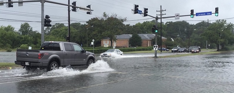
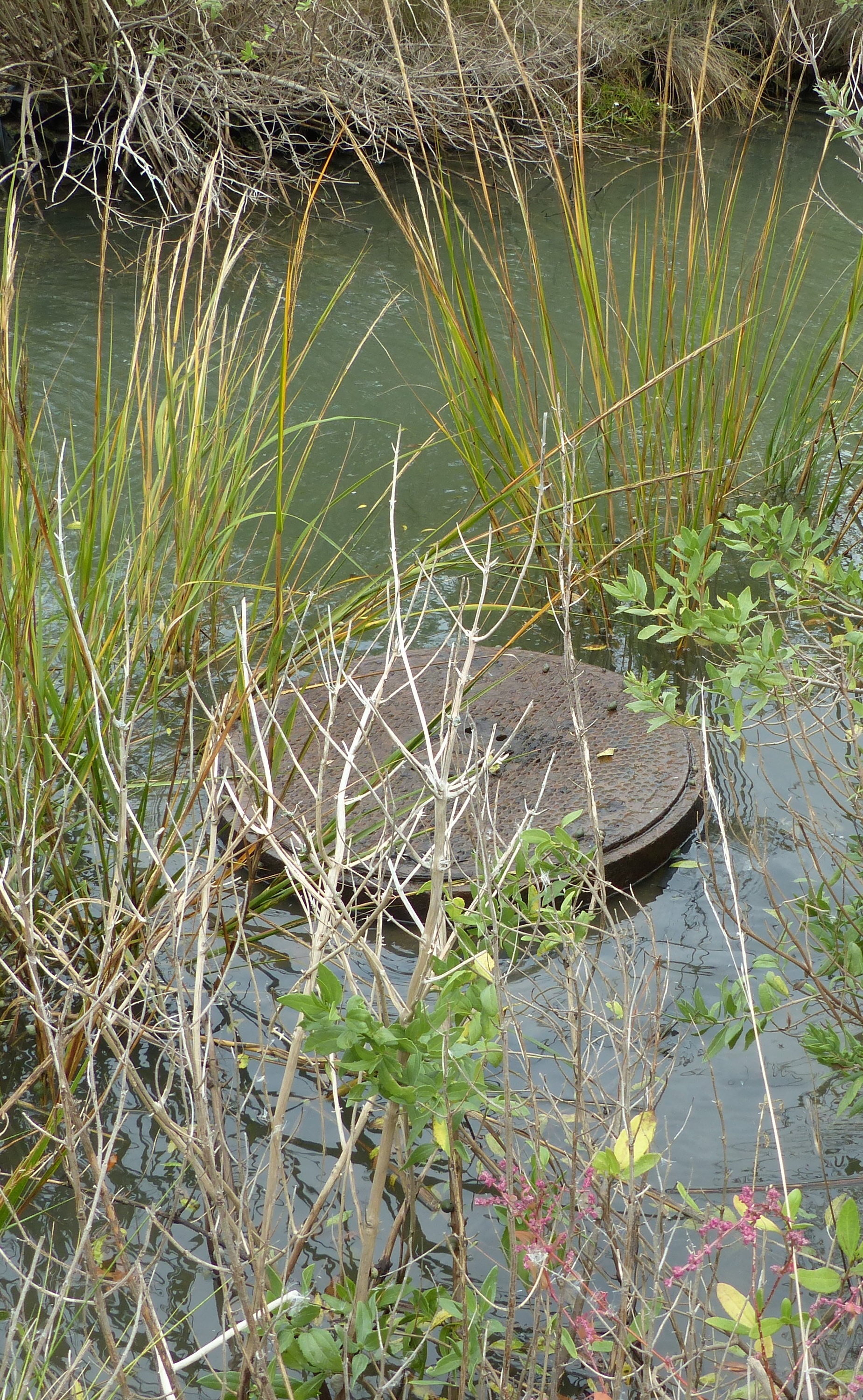
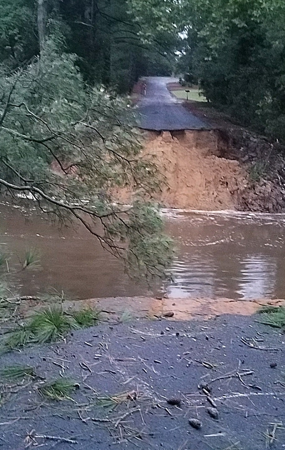
Rainfall flooding, or surface water flooding, is the flooding of land areas during and after heavy rain.  Floods occur when the ground, storm sewers, ditches, streams, and rivers become overwhelmed causing the extra water to spread out across low-lying and downstream land areas. 

In coastal Virginia, even a relatively small amount of rain can cause flooding in low-lying (low-elevation) areas.  There are two main factors that can worsen rainfall flooding:

1) The area is covered by pavement and other manmade surfaces that lack the ability to absorb water.  Rainfall flows off hard surfaces, which fills up water storage areas like ditches and storm sewers quickly.

2) The ground is already saturated or almost “full” of water.  When an area has several rain storms in a short period of time or a very high ground-water table, any additional rainfall will stay above the ground. 

Tidal Flooding ...

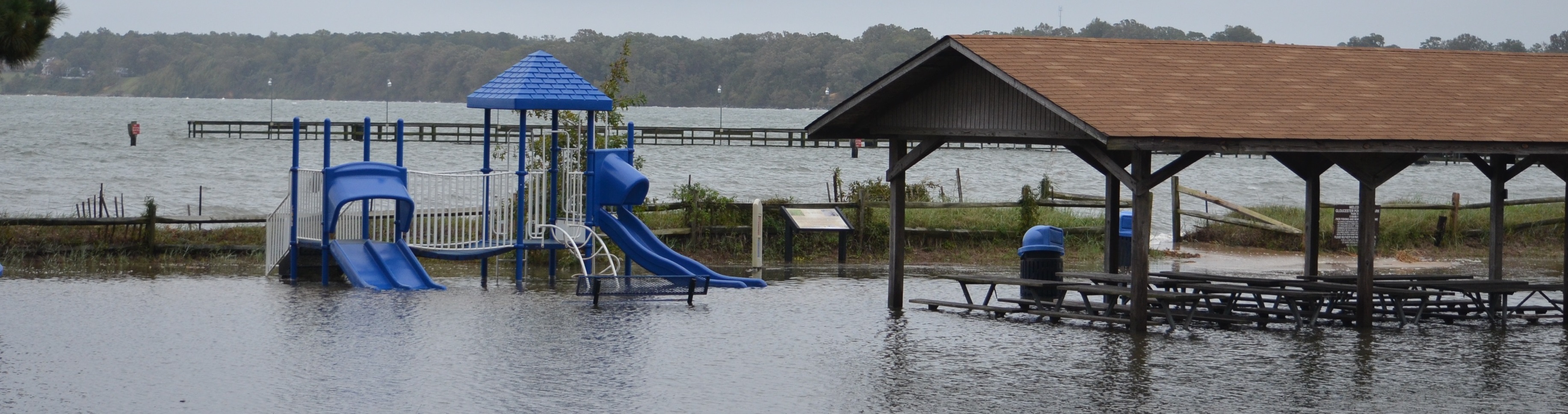
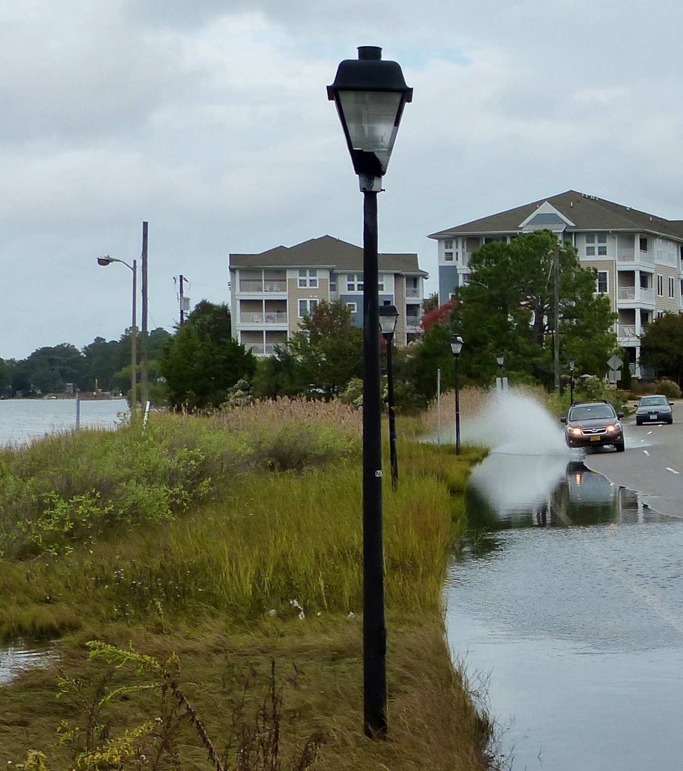
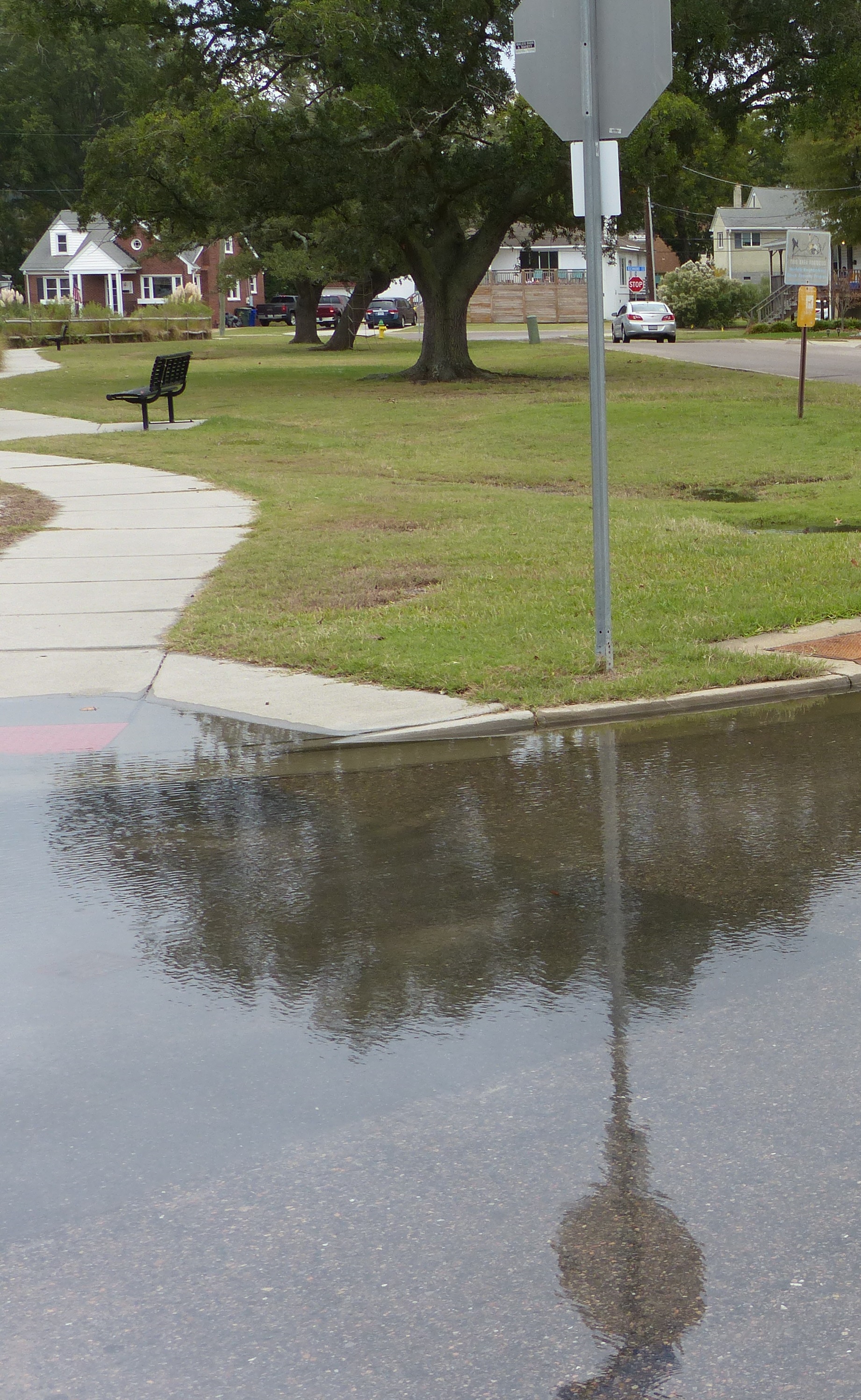
Tidal flooding is the temporary flooding of low-lying areas near the coast due to an exceptionally high tide. This kind of flooding, that typically results in less than a foot of water, is happening more often due to gradual sea level rise, land subsidence, and the loss of natural barriers.  

Tidal flooding sometimes happens during full and new moon cycles every month and during annual King Tides, which are the highest tides each year. It is also called high tide or nuisance flooding when it disrupts daily life, or ‘blue sky’ and ‘sunny day’ flooding when it happens on without a storm event. 

Frequent tidal flooding events can cause inconveniences such as mosquitoes, frequent road closures, overwhelmed storm drains, and structural damage leading to poor water quality, lower property values, and less tourism.

Combination Flooding ...

Often some combination of storm surge, rainfall, and tides will occur at the same time which can amplify the impacts of flooding and increase the uncertainties making it more difficult to successfully forecast.


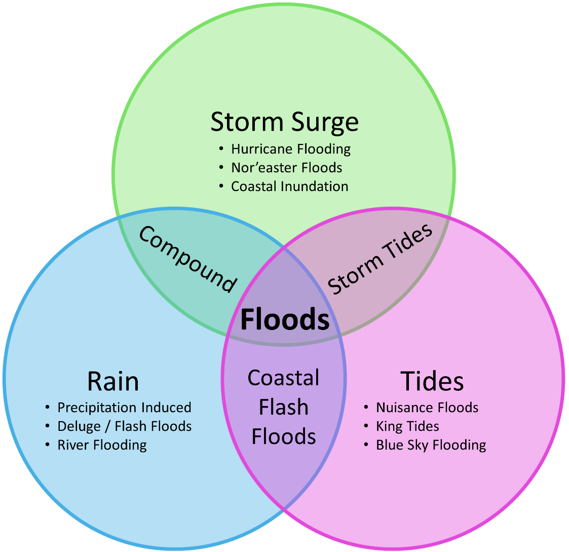
  • A combination of storm surge and high tides is often referred to as storm tides.
  • A combination of storm surge and rainfall is typically called compound flooding.
  • Heavy rainfall during tidal flooding can rapidly lead to coastal flash floods.


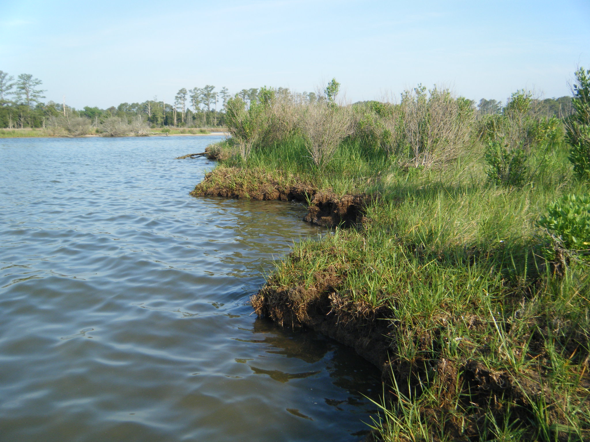
Is flooding really a problem?  Yes!  Sea level and groundwater tables are rising, precipitation is becoming more intense, tidal flooding is more frequent and storm surge flooding happens more easily because of these higher water levels - all leading to more flooding events that often come at a personal and financial cost.  Evidence of this can be seen in our neighborhoods with recurrent flooding, ghost forests, wetlands gradually appearing within developed areas and previously dry backyards, docks and piers going under water more often, community alerts and flood advisories.

"Impacts from flooding can range from temporary road closures to the loss of homes, property and life. In coastal Virginia, the cost of large storm damage can range from millions to hundreds of millions of dollars per storm." – Virginia Department of Emergency Management

Flood Facts ...

Virginia Flood Awareness Week encourages Virginians to learn about their flood risk and protect the life they’ve built with flood insurance.

  • Floods are the most common and costly natural disaster in our country.
  • 90 percent of all presidential declarations of emergency and major disasters involve flooding.
  • On average, 100 Americans lose their lives in floods each year.
  • On average, flood damages throughout the nation annually exceed $3 billion, and as of January 31, 2019, flood insurance claims in Virginia totaled more than $730 million.
  • Both direct and indirect costs of flood recovery are borne by all American taxpayers, not just flood victims.
  • Virginia has 2.3 million acres of mapped special flood hazard areas, which represents 9 percent of Virginia's land mass.
  • Only 31 percent of people who live in a special flood hazard area have flood insurance.
  • Floods can happen without warning and all Virginians should know their risk.
  • Certain communities, including those of low economic means and communities of color, are disproportionally affected by flooding events.
What is the difference between flooding and sea-level rise?

Numerous weather and human-related factors influence whether or not a flood occurs. However, as the Intergovernmental Panel on Climate Change (IPCC) noted in its special report on extremes, it is increasingly clear that climate change “has detectably influenced” several of the water-related variables that contribute to floods, such as rainfall and snowmelt. So, while Earth’s changing climate may not induce floods directly, it exacerbates many of the factors that do by increasing precipitation and melting polar glaciers and sea ice, which results in sea level rise.

"Today, Virginia has 164,000 people at risk of coastal flooding.  By 2050, an additional 137,000 people are projected to be at risk due to sea level rise." – Climate Central

  • Find out why Hampton Roads is so vulnerable to Sea-level Rise. – VIMS "A Deeper Dive", YouTube video (0:41)
  • Learn more about Sea-level Rise.
Find out more about flooding ...
  • Learn more about Nuisance Flooding and why is it becoming a bigger issue in coastal Virginia. – VIMS "A Deeper Dive", YouTube video (0:40)
  • Learn how VIMS is Forecasting Tidal Flooding by using tide gauge data and advanced computer models to generate accurate 36-hour predictions. – VIMS "A Deeper Dive", YouTube video (1:54)
  • Watch how Modeling Storm Surge helps coastal communities be more resilient and improve their economic strength. – VIMS "A Deeper Dive", YouTube video (3:10)
  • Learn about the AdaptVA web portal with tools and resources to help individuals and coastal communities think differently about how they live, work, and play along the coast. – VIMS Marine Science Day 2021, YouTube video (21:34)
  • Read about Forecasting Coastal Water Levels in Virginia – Rivers & Coast, 2018 (pdf)
  • Discover more about future flooding issues and adaptation strategies for reducing the impact of flood events in the Recurrent Flooding Study – Rivers & Coasts, 2012 (pdf)
  • Watch this example of adapting to flooding - a shed built on a floating platform designed to rise during floods without releasing the contents stored inside. – YouTube video (:06)
  • These adaptations were added in the Carl Hershner Teaching Marsh to help protect water quality and marsh habitat as well as improve access for learning.
I'M GOING TO MOVE, WHAT DO I NEED TO KNOW?

When considering a new home it is always a good idea to look into current and future flood potential! 

STEP 1 – Is there potential to flood TODAY?

Weighing a decision to move starts with gathering information on the property and general area.

  • Is the home or address in a Flood Hazard Zone?
    Knowing the location of flood zones helps property owners and buyers understand their flood insurance rate and consider floodproofing options; assists insurance agents in assessing rates; and offers builders insight on potential building restrictions and standardsFind Your Zone

  • Will some portion of the road network be underwater? When relocating, it is helpful to know how often road flooding will affect your ability to get to work or to the store and, for emergency vehicles to reach your home.  Check Road Access

  • How often does the property flood?
    Considering whether the property floods daily or only occasionally can help you to compare the benefits with potential financial costs and emotional hardships.  Check Current Flooding

STEP 2 – Is there MORE potential to flood in the FUTURE?

Understanding the trajectory of change can help us predict and possibly avoid, or prepare and hopefully defend against future flooding. 

STEP 3 – Seek Expert Advice

For on-site answers to questions concerning your specific property contact these 'in-the-know' professionals:

The Virginia Department of Health

The Virginia Department of Health will provide drinking water and septic system records for the property you are interested in.  The records include permit information, inspection reports, as-built drawings, and enforcement-actions.  The inspectors can tell you if well and septic systems in the area are prone to flooding issues, exactly what type of septic system serves a particular property and suggest some resources for alternative septic systems.

Your Insurance Agent

Your insurance agent can tell you if the property is in a flood zone, if you should consider flood insurance and how much it will cost.  If the property is in a flood zone, flood insurance might be required to qualify for a mortgage and can be very expensive.  If the property is not in a federally designated flood zone but near the water you may still prefer to have flood insurance for peace of mind as it can be relatively inexpensive.

Your Real Estate Agent 

Virginia is a “buyer beware” state leaving it up to the buyer or renter to find out if the property is at risk of flooding.  In many states, the law requires a home seller to disclose to a potential buyer any problems or defects known about the home.  In Virginia, the seller must provide the buyer with a Residential Property Disclosure Statement, (Code of Virginia § 55.1), but it essentially just tells the buyer that it is their responsibility to find any problems prior to closing. Fortunately, your real estate agent will be familiar with the area and should know to what extent flooding should be a concern.

Local Government Officials

Contact the local town, city or county environmental or planning office where the property is located for assistance looking up the current and future flood potential before purchasing real estate.  Many localities have interactive map viewers on their web sites that provide useful property information.

I LIVE IN A FLOOD PRONE AREA, NOW WHAT?

Preventing ...


Coastal resilience practices, such as living shorelines, protect both humans and natural systems by minimizing wave energy associated with flood events.  Natural and nature-based features and accommodating marsh migration are best practices to alleviate the effects of tidal flooding.  Find out more about Managing Your Shoreline.

Adapting ...

Flood adaptation refers to ways to reduce your risk, vulnerability, and/or human and economic consequences from flooding events.  See the storymaps below that explain how localities worldwide implement the three main types of flood adaptation:

  1. Management/Retreat, when natural forces are allowed to continue to function and human impacts are minimized by avoiding, minimizing or regulating human use of the coastal area.
  2. Accommodation, when people continue to use and occupy the coastal zone, but adapt their lifestyle to reduce flood impacts; (like managing transportation and water storage). 
  3. Protection, when structural (hard or soft) engineering aims to protect the land from the water.
The most common adaptive approach to flooding in coastal Virginia currently is accommodation, which includes raising buildings and roads, establishing evacuation routes and warning systems, and creating or enhancing stormwater systems.
Understanding issues with septic systems ...

Homes located in the coastal area of Virginia must contend with rising groundwater levels and recurrent flooding, making septic systems there vulnerable. Even well-maintained septic systems will deteriorate over time and can discharge into adjacent waters. 

Find out more here...

For more information, contact your local Virginia Department of Health inspector.  They are very familiar with the areas that they work in and can suggest some resources if alternative septic systems are required. 

Preparing for storms ...

When a storm is approaching there are many questions to answer like, Will the road to my house be flooded tomorrow at high tide?  At what time should I expect coastal flooding near me?

Water level forecasts shift with the tides by the hour. This Tidewatch tool makes it easier to visualize and time impacts to roads, properties, and structures over the next 36 hours based on current tidal, weather and storm-surge conditions.

What will tidal flooding look like in the next 36 hours?

See the summary directions below or, for more help step-by-step instructions (pdf with pictures).

  • Open Tidewatch Map (this will take a minute to load)
  • Put your address in the white box at the top left of the map.
  • Click the arrows on the time slide bar to see forecasted water levels either 6am to 6pm the following day OR 6pm to 6am the day after tomorrow.
  • Click anywhere on the map to open a chart with two lines: water elevation over the next 36 hours and the land elevation at that location.
  • Additional information about VIMS Tidewatch can be found here.
Deciding when and how to evacuate ...
The Virginia Department of Emergency Management encourages all residents to Know Your Zone long before a serious storm threatens Virginia’s coastal region.  Tiered evacuation zones are designated A through D.  Local emergency managers will broadcast instructions for these zones for evacuation and what routes to take, or for sheltering in place.
WHAT CAN WE DO TO HELP?

What can YOU do?

Learn more about what you can do to protect natural flood-reducing features, volunteer to help and encourage others to join you!

Think Green ...
  • Identify and protect natural wetlands and coastal forests in the local area.
  • Learn how to Plant Virginia Natives that are suitable for coastal landscapes.
  • Allow leaves and sticks to remain under trees to promote water soaking into the ground.
  • Convert turf and impervious areas near the water into forests and planted areas.
  • Sign up to participate in local Go Green programs like askHRgreen.org.
Volunteer ...
  • "Catch the King" is the world's largest environmental survey.  With the goal of improving predictive models and the future forecasting of "nuisance" flooding, citizen scientists use GPS to collect flood data during the King Tide (the highest yearly tidal event) throughout coastal Virginia. Sign up to help!
Get Involved ...
  • Encourage your locality’s elected officials to enroll in the FEMA Community Rating System for lower flood insurance premiums.
What are CCRM and VIMS doing?

CCRM is researching flooding, creating models to predict flooding, and checking the accuracy of our models by collecting real-time flooding data and comparing it to the model forecasts.  Find out more about our work on adaptation and management, flooding models and the tools that are available to help you predict flooding where you live.

Informing Policy ...

Read the Recurrent Flooding Study for Tidewater Virginia that identifies recurrent flooding issues, examines future flooding, and evaluates adaptation strategies for reducing the impact of flood events submitted to the Virginia General Assembly - January 2013.

Commonwealth Center for Recurrent Flooding Resiliency ...

The Commonwealth Center for Recurrent Flooding Resiliency provides Virginia with scientific and technical support in flooding resiliency.

Storm Central ...

VIMS Storm Central is a one-stop shop for information to help our community understand and address the coastal impacts of hurricanes and nor'easters.  During storm events, we also offer data streams, videos, and photos as conditions allow.

What is VIRGINIA doing?

Policymakers have implemented a number of regulations to help preserve natural resources and protect the public.

Flood Awareness Week ...

Governor Ralph Northam designated March 14-20 Virginia Flood Awareness Week, encouraging Virginians to learn about their flood risk and protect the life they’ve built with flood insurance.

Floodplain Management Policy ...

"Flooding remains the most common and costly natural disaster in Virginia and the United States. With more than 100,000 miles of streams and rivers, as well as 10,000 miles of estuarine and coastal shoreline, Virginia’s flood risk is statewide, comes in many forms, and is increasing because of climate change and increased development in flood-prone areas."

  • Floodplain Management Requirements and Planning Standards for State Agencies, Institutions, and Property  Executive Order 45 effective November 15, 2019, looks at the risks associated with building in flood-prone areas.