Decision Support & Technical Assistance
Science-based tools to support informed decisions about tidal resources. View management recommendations on a map. Find technical reports and links to contacts for assistance
Where to Start
An application has been submitted, now what?
Determine Jurisdiction
- Wetland Boards, local staff and property owners need to know which activities may require a permit, or more than one permit, from local, state or federal authorities. In general, any activity that is proposed along the shoreline, within 100 feet of the water or tidal marsh, or in the waterway will require permits. Shoreline features that are managed through a permit program include: tidal vegetated marsh, tidal non-vegetated flat, beaches, dunes, nontidal wetlands, all waterways and uplands within 100 feet of all of these features. Certain localities use a land-based elevation as a first cut to determine if a proposed activity will be reviewed by the wetlands board and staff. See Laws & Jurisdictions
Application Review
- What information is needed in an application and how do you know when it is complete? The application form appears long and complicated. However, the information is critical to a well-informed decision about protected resources. The Joint Permit Application available online is 32 pages. BUT, only pages 5-14, the pages in the appendix for your project type, proper drawings (page 22) and Chesapeake Bay Act information (pages 23-24) are needed for an application. The rest of the pages provide contact information and examples to assist in application preparation. A detailed breakdown of what goes into a complete application is provided on the Permit Information page.
Decision Tools
Find a recommendation for action on your shoreline...
Understand the logic and erosion control practices behind the SMM
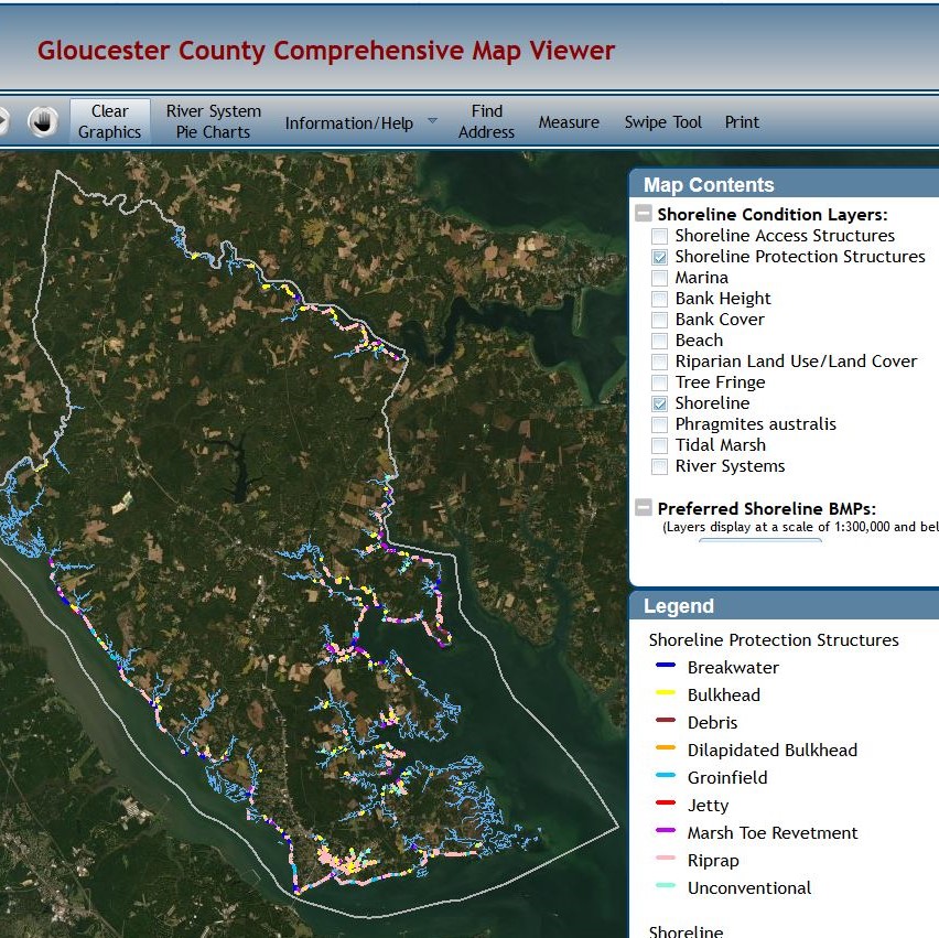
- Shoreline Management Model (SMM) – This GIS model recommends the best management practices for a shoreline using available map data and decision tree logic displayed in the Comprehensive Map Viewer. Best for desktop reviews, the model output can be viewed by locality in the CCRMPs or for all of Tidewater Virginia at ADAPTVA
See the SMM displayed in the Comprehensive Map Viewer for your locality
 Comprehensive Coastal Resource Management Portals (CCRMPs) – A gateway to locality specific shoreline information including mapping tools, shoreline and marsh inventory reports, water level and flooding information, and more.
- Shoreline Inventory Data – The Virginia Shoreline and Tidal Marsh Inventory is a series of reports and digital inventory that describe the condition of tidal shorelines in the Commonwealth of Virginia.
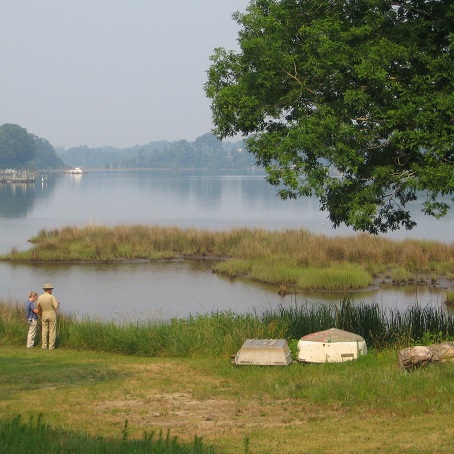
Living Shoreline Guidance
The Virginia General Assembly has a policy that living shorelines are the preferred alternative for addressing shoreline erosion.
- Living Shorelines Design Alternatives – Learn more about stabilization techniques that not only protect shorelines and infrastructure, they also help to conserve, create and restore natural shoreline habitats and ecosystem services.
- Living Shorelines Design Guidelines – Learn where they are appropriate and what is involved in their design and construction.
- Living Shorelines Training Courses – General (2010) and advanced (2017) training for shoreline professionals.
Shoreline Evolution
Shoreline changes from 1937 to 2009 have been mapped by Shoreline Studies, VIMS. Available in a map viewer and locality reports.
Technical Advice
 Need more help? State and local entities provide technical advice on shoreline management and publications are available on a variety of similar topics.
- Who Do I Ask? – Contact information for all agencies connected to the permit process.
- Wetlands Technical Reports (in Scholarworks) – Published from 1990-2002, each report provides an in-depth review of one topic related to wetlands restoration, mitigation, regulations or management.