
Thin-Layer Placement in the Classroom
CBNERR has created a lesson plan and an Esri Story Map to help teach students about marshes and thin-layer placement restoration techniques.
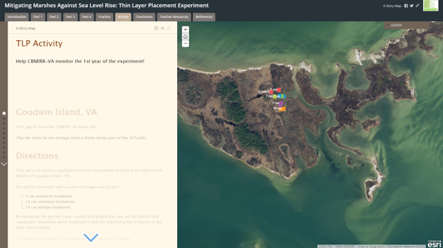
The Story Map is a digital tool that allows students to explore videos and images to analyze how vegetation has changed in CBNERR marsh experiment plots. Using this tool, students graph different treatments, determining which could be used as a possible restoration technique to combat sea level rise in marshes. Notably, the Story Map can be utilized with students independently, or can be accompanied by this lesson plan and powerpoint, found on CBNERR's Education Resources page.
These resources were developed in conjunction with a two-year experiment funded through the National Estuarine Research Reserve System Science Collaborative. Through this study, eight different NERR sites, including CBNERR, will address three core research questions: 1) is sediment addition an effective adaptation strategy for marshes in the face of sea level rise?; 2) how does marsh resilience respond to different levels of sediment addition?; and 3) how do low, versus high, marsh habitats differ in their response to this restoration strategy?.
Stephanie Letourneau, NOAA Hollings Intern, developed these resources under the direction of CBNERR education and stewardship staff.