

Environmental Data Center
The Environmental Data Center manages and analyzes CBNERR-VA data products supporting program goals. The Data Center maintains two water quality monitoring databases and associated web applications, including the Virginia Estuarine and Coastal Observing System (https://vecos.vims.edu) and the Chesapeake Monitoring Cooperative Data Explorer (https://cmc.vims.edu/), accounting for hundreds of millions of water quality samples in the Chesapeake Bay.
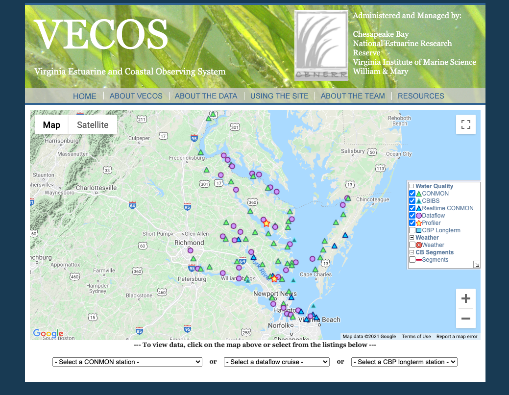
Virginia Estuarine and Coastal Observing System (VECOS)
The Virginia Estuarine and Coastal Observing System (VECOS) distributes water quality data observed by the Chesapeake Bay National Estuarine Research Reserve in Virginia (CBNERR-VA) and its partners in Virginia tidal waters of the Chesapeake Bay.
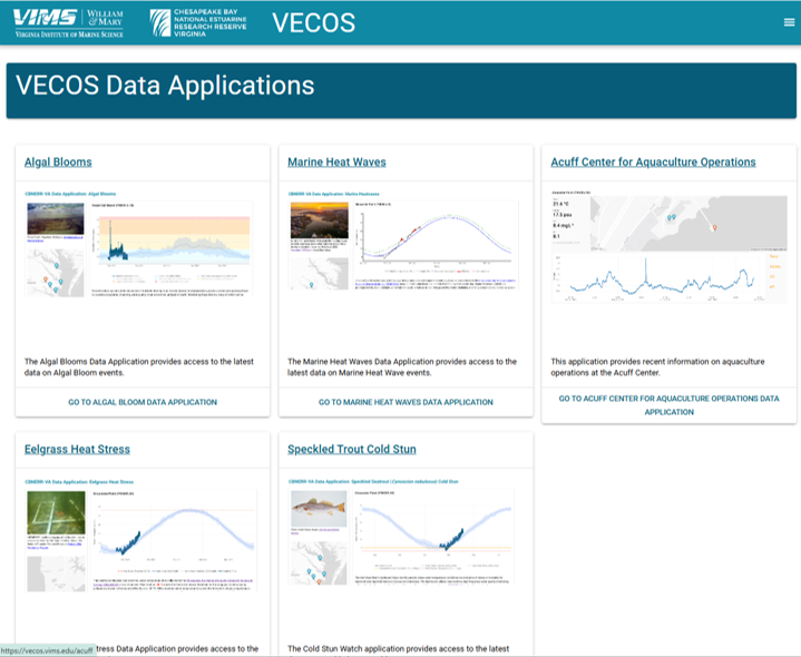
All the Apps
CBNERR-VA's Environmental Data Center uses monitoring data to inform a suite of applications. Find them here.
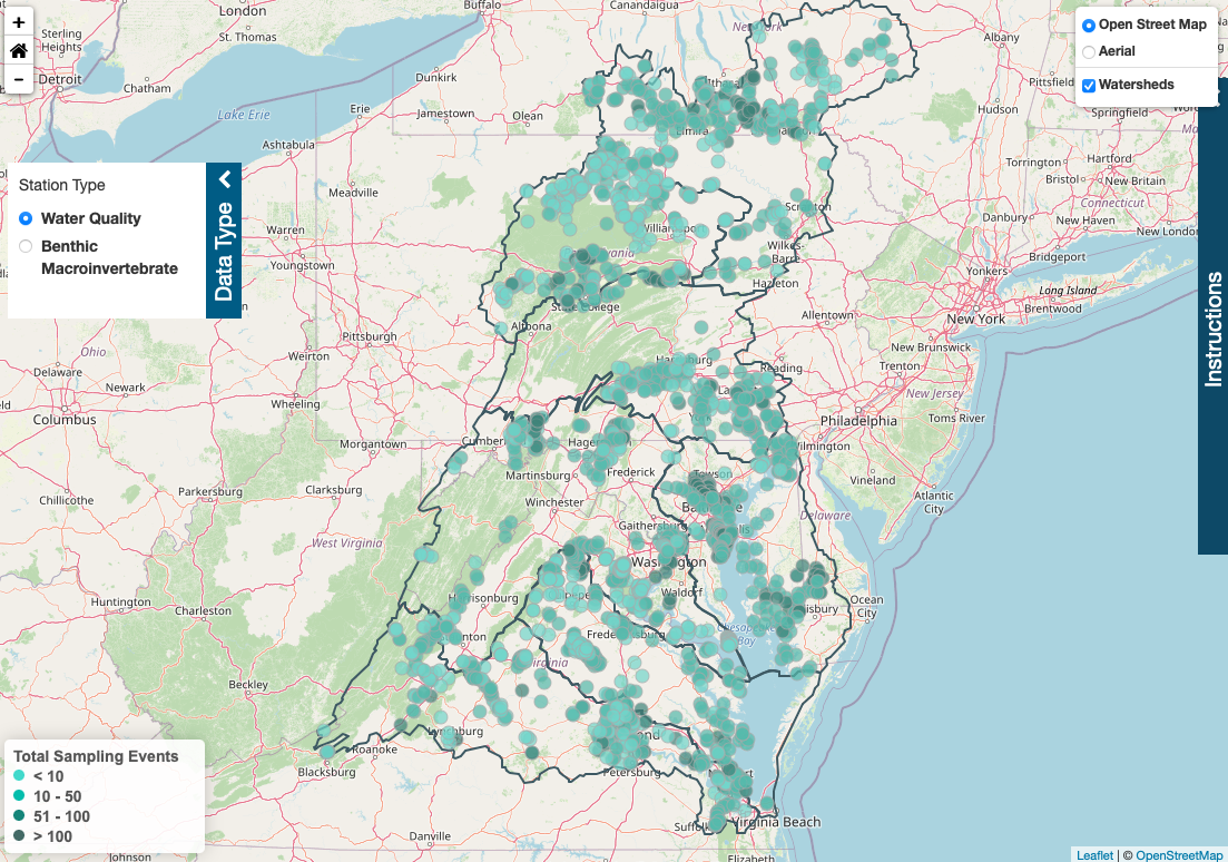
Chesapeake Data Explorer
The Chesapeake Data Explorer is a tool for storing and sharing data collected by a network of community-science based water quality and benthic macroinvertebrate monitors working at locations throughout the Chesapeake Bay watershed in partnership with the Chesapeake Monitoring Cooperative. These data are publicly accessible and are shared directly with the Chesapeake Bay Program and other data users.
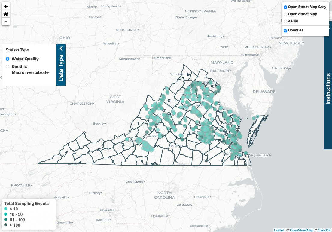
Virginia Data Explorer
The Virginia Data Explorer is a data management and access tool supporting data collected by a network of community-science based water quality and benthic macroinvertebrate monitors working at locations throughout Virginia. These data are publicly accessible and shared with the Virginia Department of Environmental Quality.
For questions regarding the Environmental Data Center, please get in touch with David Parrish, Environmental Data Center Manager