Storm Central
Explore information on how the Batten School & VIMS helps society understand and address the coastal impacts of hurricanes and nor'easters. During storm events, we also offer data streams, videos, and photos as conditions allow.
Web Cams
View water levels in real-time in the VIMS Boat Basin. This feature is disabled between storms.
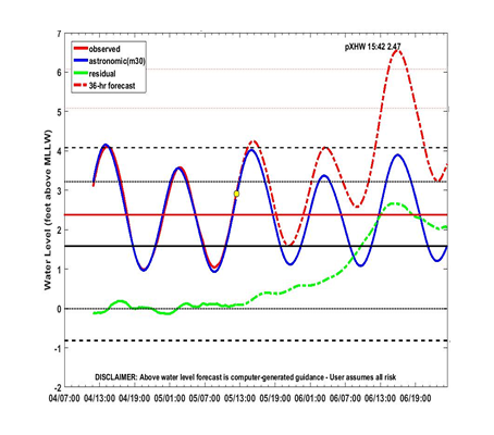
Tidewatch Charts
View 36-hour forecasts of coastal flooding at selected tide-gauge stations.
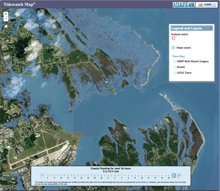
Tidewatch Map
Apply our flood forecasts to your own Tidewater neighborhood.
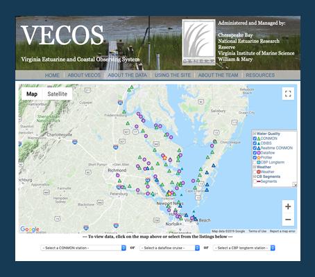
VECOS
Monitor wind speed and wave height at locations around the Chesapeake Bay.
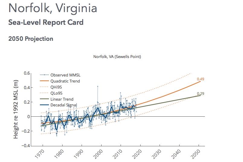
Sea-Level Rise
Rising seas increase the probability of coastal flooding from future storms.
Modeling
Underlying many of our coastal flooding tools and forecasts is the SCHISM model developed at VIMS. This cutting-edge model can predict a hurricane’s storm tide at the level of individual neighborhoods and streets—a much finer scale than current operational methods.