

StormSense wins 2018 Government Innovation Award
Hampton Roads partnership enhances flood response
Using technology to capture tidal information at the street level has garnered Norfolk, Virginia Beach, and Newport News a national award in innovation through the StormSense Project led by Dr. J. Derek Loftis of the Virginia Institute of Marine Science. This marks the 7th award StormSense has received in the last year.
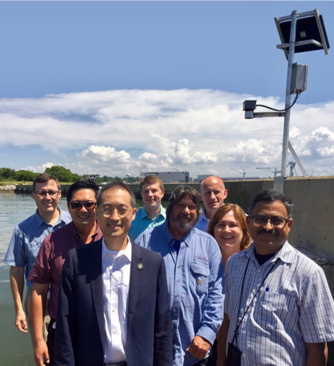
StormSense—a partnership among VIMS, the three localities, the Commonwealth Center for Recurrent Flooding Resiliency (CCRFR), and the National Institute of Standards and Technology—was recognized with a Public Sector Government Innovation Award on August 23rd. The CCRFR is a partnership among VIMS, William & Mary’s Virginia Coastal Policy Center, and Old Dominion University.
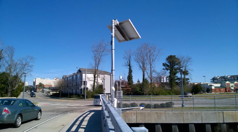
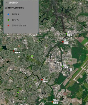
StormSense currently encompasses a network of 28 water-level sensors that gather data used to enhance emergency preparedness for flooding resulting from storm surge, rain, and tides. Many of the sensors are mounted on small bridges that cross the tidal creeks scattered throughout Hampton Roads.
The network has grown significantly during the last year, as Newport News installed 10 new sensors, Norfolk 6, and Virginia Beach 12, effectively doubling the number of water-level-monitoring assets in the region. The network is an example of the "Internet of Things" or IoT, the interconnection via the Internet of computing devices embedded in everyday objects, enabling them to send and receive data.
 The StormSense project was initially funded by the National Institute of Standards and Technology via a Replicable Smart City Technologies grant. The installation of an additional 6 sensors during the coming weeks is being funded through an award from Natural Resources Defense Council.
The newly-installed suite of sensors the will be integrated with VIMS’ Tidewatch Network, operated through the CCRFR, to provide 36-hour tidal forecasts at new sensor locations to enhance the reach of their existing tidal-prediction network. This effort, integrated with other modeling technologies, will aid in improving flood predictions throughout the lower Chesapeake Bay.