2. Survey Design and Field Methods
 2.1 Link to Dredges as Sampling Tools
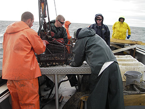
Survey methods are driven by the need to survey an extensive spatial region in a limited (by biology and weather) time period with limited resources (one vessel plus crew, limited budget). Oyster reefs offer spatial non-homogeneity at scales from centimeters to hundreds of meters laterally, and present a stratified structure vertically from living overlay, through shell above the sediment-water interface (oxic layer), through buried shell below the sediment-water interface. All of these components are important in a complete assessment of reef, and thus population integrity. Available survey methods represent inevitable compromises in the complete system description.
All quantitative sampling gear has strengths and weaknesses. In Virginia there has been a historic (and continuing) oyster survey using a dredge; however, these data are not swept area corrected and are therefore qualitative at best. For the current assessment surveys employ a hydraulic patent tong. We offer a brief discussion of the strengths and weaknesses of dredges, mechanical patent tongs, and hydraulic patent tongs.