How long is Virginia's shoreline?
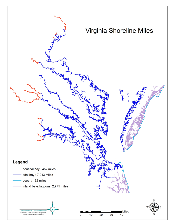
Virginia has thousands of miles of shoreline, which can be divided into various categories based on the nature of the adjacent water body. The shoreline of the tidal portions of Chesapeake Bay and its tributaries stretches 7,213 miles. Adding the Maryland portion of the Bay brings the total length of Chesapeake Bay's shoreline to 11,684 miles—more than the entire west coast of the United States. This map of Virginia's shoreline miles was created in 2007 by GIS analyst Tami Rudnicky in the Center for Coastal Resources Management (CCRM) at the Virginia Institute of Marine Sciences (VIMS). The source for the map data is CCRM's Mean High Water Shoreline Position, Virginia (SHLALL83), which was digitized from U.S Geological Survey 7.5 minute topographic maps in 1991.