Atlantic Sturgeon
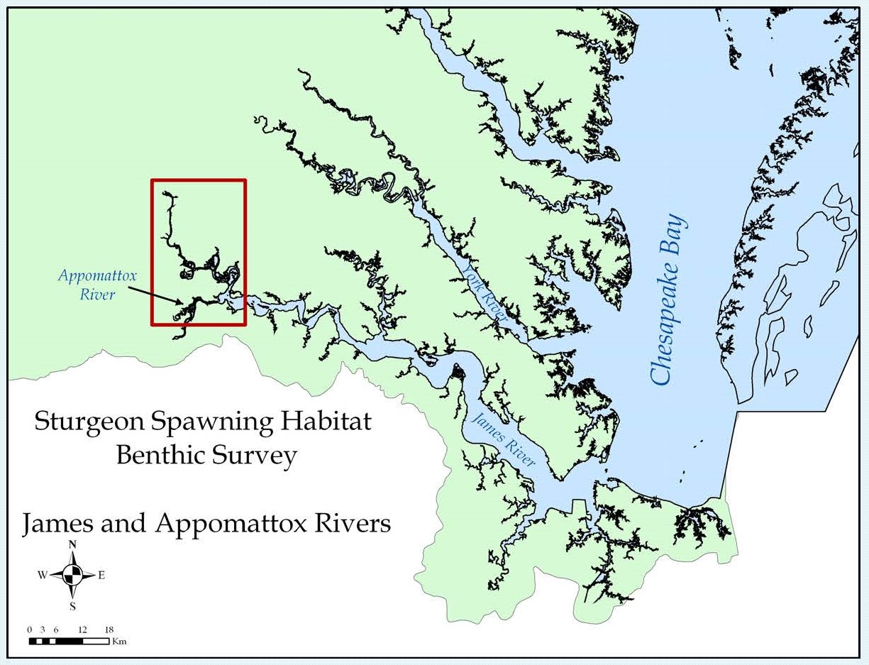
Atlantic Sturgeon Spawning Habitat on the James River, Virginia
 The Atlantic sturgeon is an anadromous species that migrates from the ocean into coastal estuaries and rivers to spawn. In the Chesapeake Bay, Atlantic sturgeon historically spawned in all the major tributaries of the Bay. Presently, spawning populations have been drastically reduced due to overfishing, pollution, dam construction and habitat degradation. Low sturgeon population levels have hindered the location of viable spawning reaches through direct observation of habitat use within Virginia’s major tributaries, James, York, and Rappahannock. However, anecdotal evidence and the capture of early juveniles indicate the possibility of successful spawning occurring in the James and York Rivers. Vital to the restoration of Atlantic sturgeon populations in Virginia, is an understanding of the quantity and quality of available suitable spawning and nursery habitat.
Several habitat parameters are hypothesized to be essential for viable spawning, including salinity (salt front to the fall line), hydrodynamic complexity (e.g. eddies with fast moving flowing reaches), high dissolved oxygen (>4mg/L), and proper spawning substrate to facilitate adhesion of eggs. The location of reaches of hard bottom benthic habitat which is a probable limiting factor for successful spawning (Bushnoe et al. 2005) will enhance Atlantic sturgeon restoration efforts.
CCRM Research
Using acoustic surveys and specialized post-processing techniques (side-scan sonar, classification software and underwater videography), we identified suitable spawning substrate (rock, gravel, cobble) within the known range of historic spawning in the James River, Virginia. Results are geo-referenced within Geographic Information Systems (GIS) allowing for the incorporation of additional habitat quality information to develop spatially-explicit habitat suitability models.
Objectives
- Assess the availability of suitable spawning habitat in the James River for Atlantic Sturgeon by characterizing benthic habitat with acoustic surveys within the known range of historic spawning.
- Delineate and geo-reference the location of viable hard bottom spawning habitats for future evaluation with additional habitat quality information
Summary
-
20% (1.2 km2) of the processed riverbed (5.8 km2) classified as hard substrate
-
Benthic characterization provides spatially-explicit information on available spawning habitats. It can be used for targeting potential restoration reaches & habitat suitability modeling.
-
With any remote classification techniques, further verification of spawning habitat viability is needed for site-specific activities. For e.g. underwater video at select river areas can be used to qualitatively assess siltation problems on a limited temporal scale, but longer term intensive evaluations of siltation patterns on site may be necessary to ensure spawning habitat restoration success.
Spawning Habitat MapsFour distinct classes were defined by post-processing acoustic imagery with QTC SIDEVIEW and ground-truth surveys: 1. sand/silt, 2. sand with bottom complexity (e.g. shell, benthic growth), 3. rock/bedrock, and 4. gravel/cobble/pebble.
|