

Gloucester Point
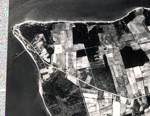
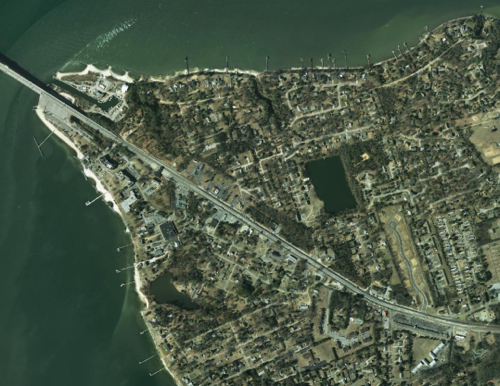
These before and after aerial images show land-use changes in Gloucester Point, Virginia between 1937 and 2011. Note the addition of the Coleman Bridge (upper left-hand corner) and George Washington Memorial Highway (Hwy 17; center of the image). The Virginia Institute of Marine Science (VIMS) is in the left-central part of the images.