

Barrier Island Dynamics
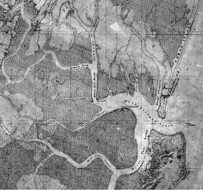
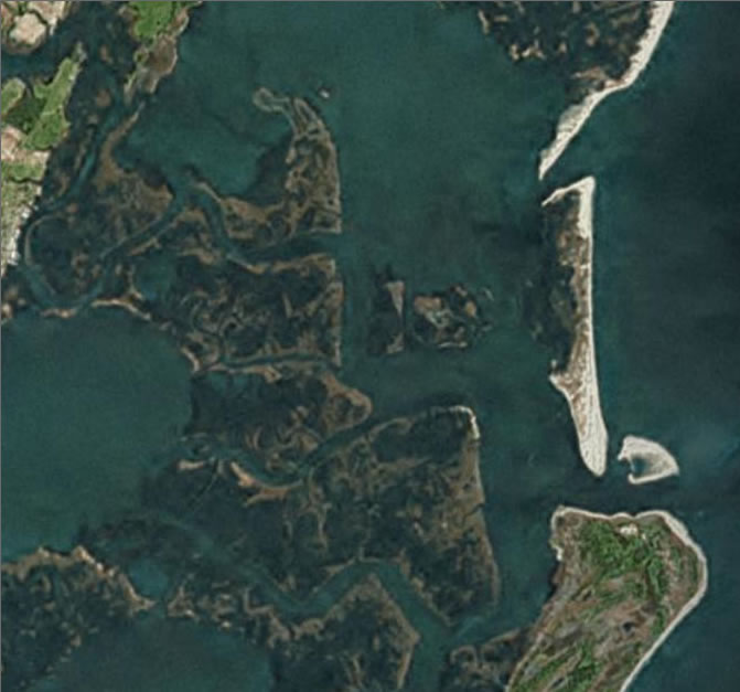
Changes in Wachapreague Inlet 1871-2006
Don't see an image? Try reloading your browser window one or more times.
Landward migration of Cedar Island (upper right) on Virginia's Eastern Shore between 1871 and present has led to large-scale loss of back-barrier marshes and dramatically changed the configuration of tidal inlets and back-bay channels. The 1871 map is from NOAA's Historical Shoreline Survey, which provides access to almost 8,000 surveys—the earliest dating back to 1841—conducted by NOAA and its predecessor organizations. The modern image (from 2006) is via Google Earth©. Learn more about how VIMS researchers are using comparison of historical and modern images to study barrier-island dynamics.