

Story Maps
Story maps are a great way to visualize ideas, facts, history, changes, processes and procedures involving the Chesapeake Bay in Virginia. Much can be told by incorporating maps, images, and text together. Some great stories talk about Shoreline Change, dunes, management plans and beaches.
Please enjoy the Story Maps below:
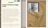 |
Tangier Island's Past and Future |
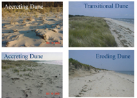 |
Dune Inventory of the Chesapeake Bay |
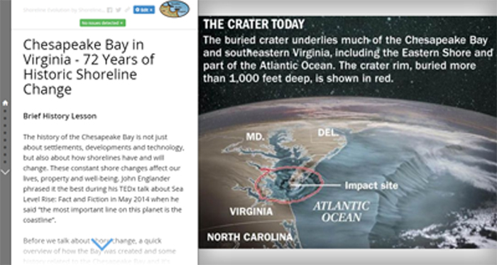 |
Chesapeake Bay - 72 Years of Shoreline Change |
 |
Example of how Shoreline Management Plan Procedure |
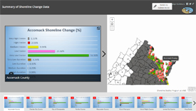 |
Summary of Shoreline Change Data |