

Shallow Draft Dredging
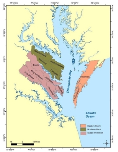
| Channel dredging on the Middle Peninsula, Northern Neck and Eastern Shore is usually considered when the safe navigation into and out of a creek, access channel or other shallow navigation waterway is impended. | Select Channel Reports |
 Historically, Federal designated channels were authorized by Congress in the 1950s to 1970s to support the commercial seafood industry and working waterfronts. When the natural channels were not sufficient to allow safe passage, channels had to be created by dredging. Each channel is unique in terms of tidal hydrodynamics and the need for maintenance dredging, so their extent and controlling depths vary depending on the nature of boating requirements. Controlling depths vary but generally range from 6 to 10 feet MLW. Channel widths vary from 60 to 100 feet depending. These size and depth parameters helped determine the amount of dredging that was required. The consequent disposal of the dredge material also varied from upland to shoreline to offshore sites. Many of these initial disposal sites are no longer available.
Dredging Implementation Prioritization and Management for Middle Peninsula Shallow Draft Channels (VIMS 2021) report provides base data for 120 creeks and channel on the Middle Peninsula. The data collected was used to prioritize dredging needs based on physical parameters. Once the creeks were prioritized, the steps localities need to take for additional data collection to develop a dredging project were outlined.
The goal of Rural Shallow Water Dredging: Channel Assessment and Disposal Sit Strategies (VIMS 2019) report is to provide general considerations for localities on the dredging and disposal of material from shallow draft channels, in particular for those channels on the Middle Peninsula, Northern Neck, and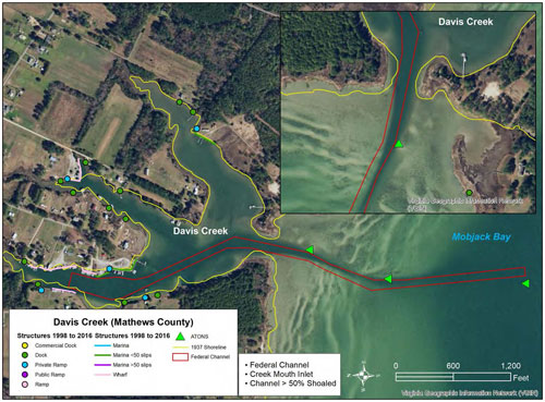 Eastern Shore of Virginia. This report offers background on shallow draft channels, both federally and non-federally maintained and suggests procedures for the dredging and disposal process. Existing data on the Middle Peninsula, Northern Neck, and Eastern Shore channels are provided to assist localities with management decisions. In addition to creating and collecting data for most of the existing federal channels, Davis Creek in Mathews County, is used as an example of what steps need to be taken and what data are necessary for maintenance dredging and disposal.
Other publicly available Selected Dredging Data and Guidance References are listed below.
Northern Neck Regional Shallow Draft Channel Dredging Plan: Initial Phase
Northern Neck Regional Shallow Draft Channel Dredging Plan: Feasibility Phase
Dredging and Dredged Material Management (USACE, 2015)
Beneficial Use Projects Using Dredged Material (EPA\USACE, 2007)
Guidance and Best Practices for Determining Suitability (Brandon & Price, 2007)
Eastern Shore of Virginia Regional Dredging Needs Assessment (ANPDC, 2016)
Shallow Draft Navigation and Sediment Plan for Middle Peninsula (MPPDC, 2011)