Depth to 3 mg/L Dissolved Oxygen
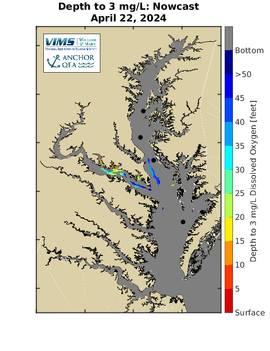
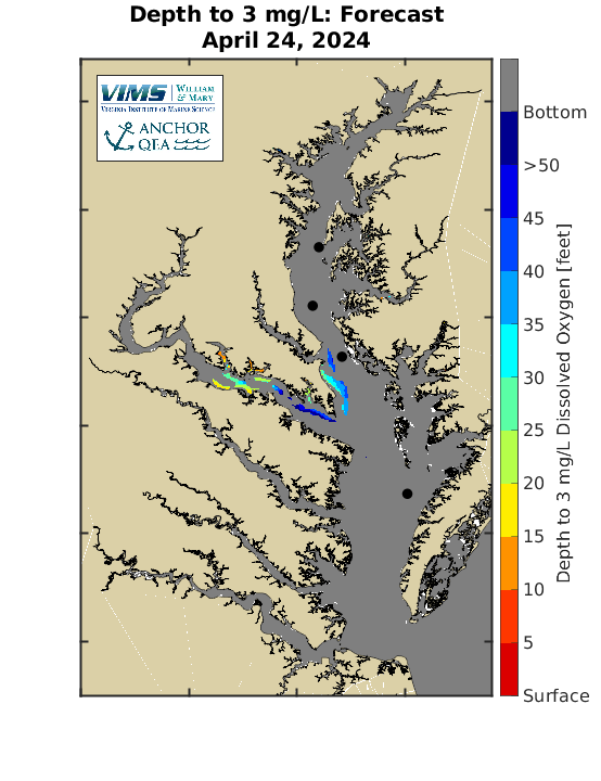
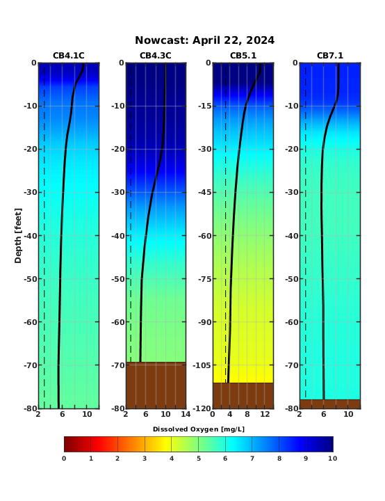
Quick SummaryFish habitat and productive fishing areas in the Chesapeake Bay are squeezed in the summer by areas of low dissolved oxygen. The Chesapeake Bay Environmental Forecast System is used to visualize this habitat squeeze by estimating the depth below the water surface to a dissolved oxygen concentration of 3 mg/L. Below, maps show the depth in feet to 3 mg/L dissolved oxygen concentration, with gray coloring indicating the dissolved oxygen concentration is greater than 3 mg/L all the way to the bottom. The last image shows vertical profiles of dissolved oxygen at the locations shown with dots on the maps. Vertical profiles progress from CB4.1C in the north to CB7.1 in the south. |
Quick Links
Depth to 3 mg/L: Nowcast

Depth to 3 mg/L: Forecast

Depth Profiles: Nowcast

