

Hampton Flood Gauge 05 (Spider Crab)
The Barking Dog, Hampton River
This is one of six (6) citizen-science monitoring gauges that were installed by High School Student, Olivia Basco, from Hampton Roads Academy, through the award of a 2018 Hal Tayloe Scholarship. This Spider Crab gauge is installed near the Barking Dog, over the Hampton River and is vertically referenced to Mean Lower Low Water (MLLW = 0 ft.). The nearest water level sensor to this site is a USGS sensor at Hampton, over the Hampton River ~1.1 mi. away. VIMS' 36-hr. Tidewatch tidal forecast at this site is shown below as the red dashed line:
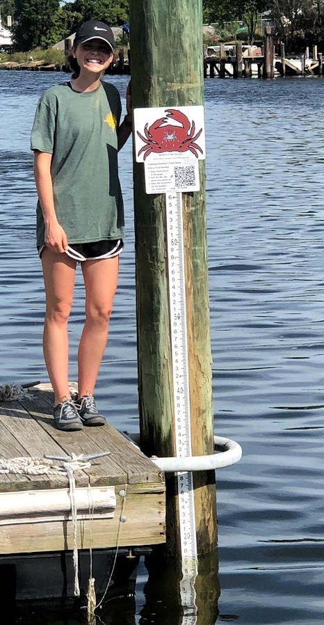
Strategically placed to attract the most participation based on locations surveyed durting Catch the King 2017, each site has a QR code along with simple instructions, a link to learn more, and a crab graphic Olivia designed based on the city's crab mascot. Citizen-scientists hold their smartphone cameras up to the QR code in order to be directed to an online form (example here).
The online form asks a series of questions: water height (which the user reads off of the gauge itself), the reason for the water depth (tide conditions, recent storm, etc.), a current photo of the gauge, the location (coordinates located on the gauge; some mobile devices will autofill this information via location services), the time (automatically sets current time), and any additional comments. The data are available for viewing on the interactive form below, used by UNC through the King Tides Monitoring Initiative:
.