

Researchers issue real-time forecasts of Chesapeake Bay dead zone
Simple model holds promise for anglers and other Bay users
An experimental forecast from William & Mary’s Virginia Institute of Marine Science will soon help Chesapeake Bay anglers better plan for the appearance of low-oxygen “dead zones.”
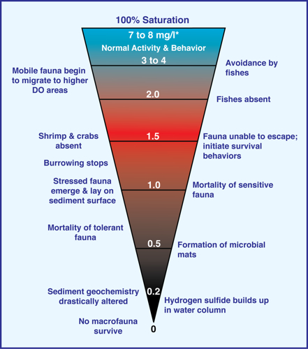
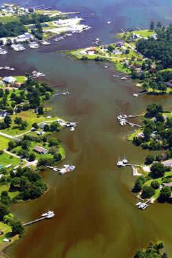
Dead zones form when excess nitrogen from fertilizers, wastewater, and other sources enters coastal waters and fuels short-lived blooms of algae. Bacteria then eat the dead, sinking algae, consuming dissolved oxygen from surrounding waters.
Predicting the general outline and seasonality of dead zones is fairly straightforward—a large pool of oxygen-poor water typically occupies the deeper parts of the Bay’s main channel during the summer doldrums, when hot weather drives gases from the water and encourages algal growth, while calm winds minimize the waves and currents that would otherwise help mix relatively oxygen-rich surface waters into the depths.
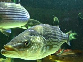 But predicting day-to-day changes in the size and shape of the Bay’s dead zone is more of a challenge—and exactly where VIMS’ forecast will add value to anglers searching for striped bass and other cool-water species. When oxygen declines in the deeper, cooler waters these fishes prefer, they are forced from their habitual haunts into areas where anglers might not think to look.
Professor Marjy Friedrichs, who leads development of VIMS’ daily dead-zone forecasts, says “We held a stakeholders meeting this spring to better understand how charter boat captains and others on the Bay might use our modeling capabilities, and what kinds of forecasts would be most useful. They were enthusiastic about a short-term dead-zone forecast and said they could use it to help plan where they’re going to fish.”
 Friedrichs is collaborating on the dead-zone model and forecasts with researchers at VIMS and from around the region. Colleagues include fellow VIMS researchers Dr. Carl Friedrichs and Dr. David Forrest, Dr. Raleigh Hood of the University of Maryland Center for Environmental Science (UMCES) and Dr. Malcolm Scully of the Woods Hole Oceanographic Institution.
The researchers’ ultimate plan is to incorporate their real-time forecasts into more comprehensive monitoring and prediction products such as NOAA’s Chesapeake Bay Interpretive Buoy System (CBIBS) and the Mid-Atlantic Regional Association Coastal Ocean Observing System. MARACOOS is part of NOAA’s larger Integrated Ocean Observing System, or IOOS. Major funding for the team’s work comes from the IOOS Coastal Ocean Modeling Testbed, managed by the Southeastern Universities Research Association.
Real-time forecast model
VIMS’ real-time daily forecasts of Bay dead zones are enabled by use of a computer model that simplifies the Bay’s complex biology while still accurately simulating the Bay’s physical dynamics. It complements the seasonal predictions of Bay oxygen developed by NOAA-sponsored researchers at UMCES and the University of Michigan, as well as the more comprehensive water-quality models used by NOAA, the Environmental Protection Agency, and other agencies to track the restoration of Bay health.
“Our model is much simpler than the complex models used to predict overall water quality in the Bay,” says Marjy Friedrichs, “but it predicts dead-zone dynamics just about as well.”
Forrest—borrowing from the world of finance—says forecasting with the dead-zone model “is like using an index fund to predict trends in the stock market,” rather than betting on the ups and downs of individual companies. “Our biology is represented by a single setting in the model,” adds Carl Friedrichs, “while in the more complicated models the biology is interacting with lots of other factors, and thus often changing.”
 The upshot of these differences? If the more complex models—with up to five different groups of interacting organisms—get all the biology right, their predicted oxygen levels can be highly accurate. But if they get it wrong for even one group, say an incorrect respiration rate for a particular type of algae, their real-time prediction may be well off the mark. The dead-zone model, on the other hand, charts a middle course—with real-time forecasts that are unlikely to be exactly right, but also less likely to be wildly wrong, and more often than not within a reasonable range of observed values.
Maps built on user input
The new VIMS product—officially known as the VIMS Hypoxia Forecast Tool—uses three maps to characterize oxygen levels in the bottom waters of Chesapeake Bay. The first map simulates current conditions, what the scientists call a “nowcast.” The second forecasts oxygen levels three days in the future. The third shows the difference between the nowcast and the three-day forecast, in terms of a percent change in oxygen per day.
Marjy Friedrichs says the forecast interval was based on input from charter boat captains during this spring’s stakeholders’ workshop. “They told us they choose their fishing sites within three days of heading out, and we also had concerns about the accuracy of weather forecasts beyond that time.” Simulations with the dead-zone model depend on NOAA forecasts of wind speed and direction, as well as data on the volume of tributary flow provided by the U.S. Geological Survey.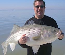
The modeling team is also working to implement additional stakeholder suggestions. One is to provide output from other dissolved-oxygen models for comparison with the current forecast. This “ensemble” approach—used also in forecasting hurricane tracks—can lend credence to forecast values and help improve model accuracy. Another plan is to provide forecasts of salinity and water temperature, also parameters that anglers use to locate fish. A third enhancement is to compare predicted oxygen values with those observed at the 10 CBIBS buoys around the Bay. The team plans to initiate this comparison with Gooses Reef, the only CBIBS buoy that now provides real-time readings of dissolved oxygen on the bayfloor.
Other possible enhancements, but further down the road, include extending the forecast into shallower areas. Because of the resolution limits of the current model, the present forecast is limited to waters deeper than about 15 feet.