

Southeast Atlantic Coast
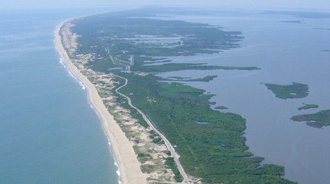 The barrier islands are fragile strips of beach, dune, and marsh between Virginia’s southeast Atlantic Ocean coast and Back Bay. Photo by Shoreline Studies Program
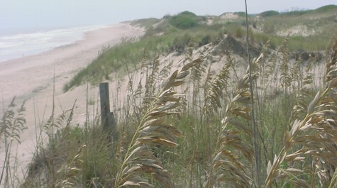 The barrier islands have long stretches of undeveloped beaches and dunes. Photo by Shoreline Studies Program
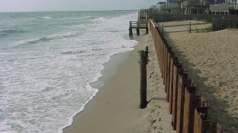 At Sandbridge Beach, bulkheads protect shoreline, but continued shoreline erosion has reduced the width of the beach. Photo by Shoreline Studies Program
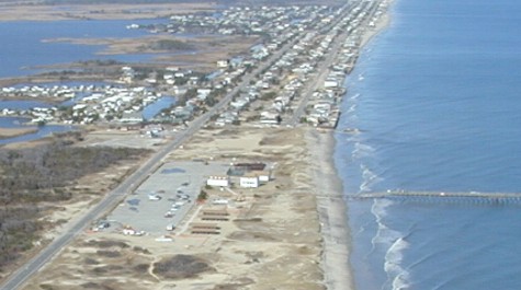 Sandbridge Beach before a dredge project in 2003. The beach is narrow and the dunes are eroding at Little Island Park and there is not high water beach along the shoreline north. Photo by Shoreline Studies Program
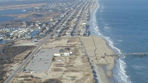 Sand is pumped from offshore onto the shoreline. Photo by Shoreline Studies Program
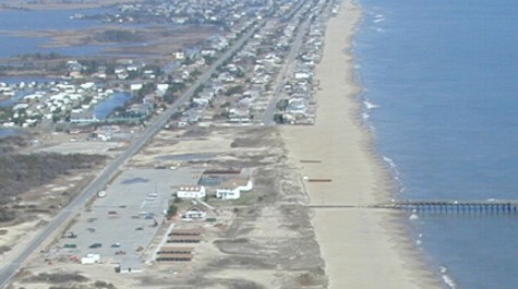 A wide, protective, and recreational beach has been placed along Sandbridge shoreline. Photo by Shoreline Studies Program
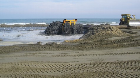 Sand fill being pumped up onto Virginia Beach’s resort beach. Photo by Shoreline Studies Program
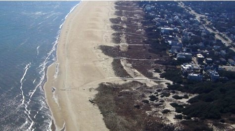 The north end of Virginia Beach has wide beaches and dunes due to the transport of beach renourishment sand from the resort area. Photo by Shoreline Studies Program
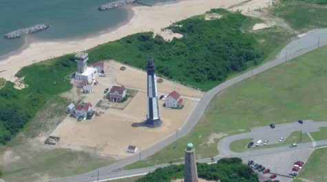 A series of breakwaters were placed offshore at Fort Story in order to maintain the military installation’s beaches as well as protect upland infrastructure from erosion. Photo by Shoreline Studies Program
Atlantic Ocean Beaches and Dunes of Southeast Virginia
Virginia’s southeast ocean coast consists of the City of Virginia Beach, Naval Air Station Oceana Dam Neck Annex, Back Bay National Wildlife Refuge, and False Cape State Park. 
Back Bay National Wildlife Refuge and False Cape State Park are natural barrier islands between Back Bay and the Atlantic Ocean. These parks contain a large swath of undeveloped areas along the Atlantic coast. Access is limited at these parks (there is no public vehicular access) so that undeveloped, natural shorelines can exist. Swimming, sunbathing, surfing, and other non-wildlife-dependent activities are prohibited. These beach and dune habitats are important to many plants and animals and are a critical segment of the Atlantic Flyway. Sea oats, beachgrass, and wax myrtle cover the dunes and provide habitat for a variety of invertebrates, small mammals, and nesting songbirds. Threatened loggerhead sea turtles come ashore to nest every summer. Sandpipers, sanderlings, and willets feed in the intertidal moist sand. Osprey, gannets, gulls, and terns can be seen fishing offshore.
North of these two parks is the City of Virginia Beach. Virginia Beach encompasses the most accessible portions of Virginia’s southeast ocean coast. Little Island Park, on the south end of Sandbridge, is a city-owned park that provides public beach access. This section of Virginia’s ocean coast erodes at about 2 feet per year and is a divergent area of sediment transport (2006 MMS report). This means that north of Little Island Park, sand moves north. South of Little Island, sand moves south.
Historically, Sandbridge residences have been continually threatened by erosion. Various methods of shoreline management have been used over time at Sandbridge. Bulkheads were built to protect houses, but scour, particularly during storms caused bulkhead failures. Beach scraping to create a backshore mound of sand and dune fencing were temporary solutions. To protect property and provide beaches for tourism, the City of Virginia Beach began renourishing Little Island and Sandbridge. Sand is dredged from shoals offshore and pumped onto the beach where it is spread by heavy equipment.
Virginia Beach began renourishing its resort beaches regularly in the 1950s in order to provide storm protection and the recreational beaches which are so important to its economy. Because s and is transported north along the City’s shoreline, the northern residential section of Virginia Beach has very wide beaches and dunes created from 60 years of beach nourishment. Cape Henry also has wide beaches and dunes, but when erosion began to threaten the beaches used for military training and the Cape Henry Lighthouse, a series of breakwaters were installed along the shoreline.
Naval Air Station Oceana Dam Neck Annex is located in the middle of the City of Virginia Beach’s Atlantic shore, which provides unique facilities for training. Dam Neck also has been renourished regularly to maintain a wide, protective beach. In addition, a large dune was built to protect upland infrastructure from storm surge. This large dune has a rock core that will hold the shoreline if the entire dune is lost. The front of the dune has eroded during storm events, but installing sand fences after small events and renourishing after large has maintained a protective dune on the ocean coast.
More Information
Beachfront Q&A: All about dunes, development, storms, and sea level rise.
City of Virginia Beach Tourism