

Eastern Shore Lab Web Cam
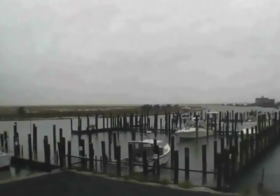
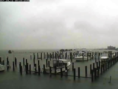
These images show the difference in water level at the Virginia Institute of Marine Science's Eastern Shore Laboratory in Wachapreague during the passage of Hurricane Sandy. The left-hand image was captured at 4:41 pm on Sunday October 28 (near low astronomical tide), while the right-hand image was captured at 9:27 am on Monday, October 29 (near high astronomical tide). See Tidewatch for predicted water levels at this station.
Also compare water levels at the Yorktown Coast Guard Training Center during hurricanes Sandy and Irene.