

Catch the King
Model Validation
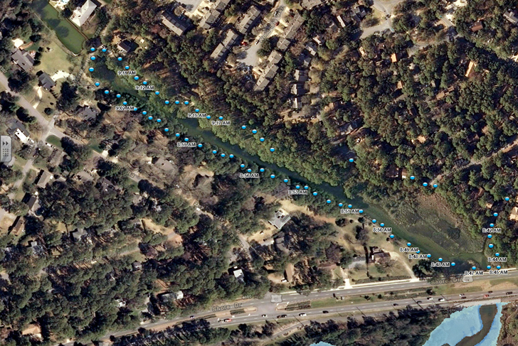
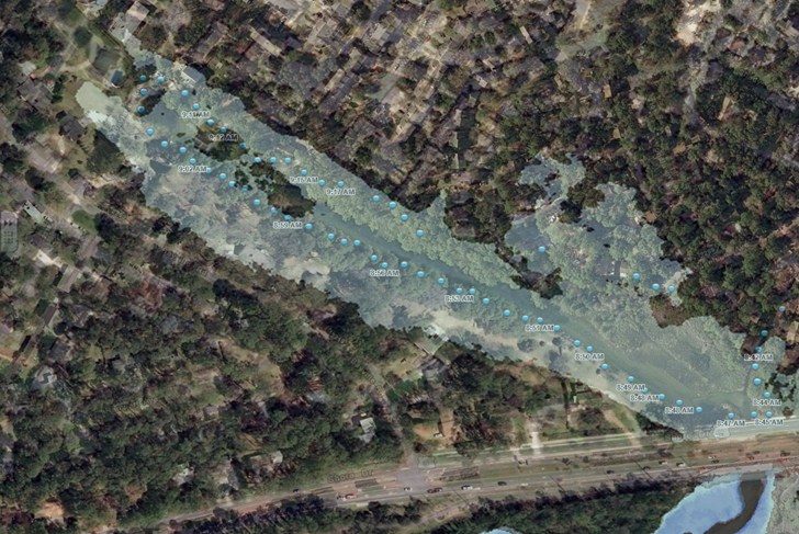
A forecast from VIMS' street-level inundation model before (L) and after (R) input from volunteers during the 2017 Catch the King event. Pictured are the upper reaches of Pleasure House Creek in Virginia Beach. The data the volunteers collected using the Sea Level Rise app (blue dots) revealed that the elevation beneath the Shore Drive bridge—obscured during LIDAR overflights—is low enough to allow flood waters to inundate the upstream neighborhood. The data points don't perfectly match the modeled flood extent in the right-hand picture because they were collected before the peak extent of the tide.
Learn more about VIMS' involvement in the Catch the King event.