

Maps & Charts of Chesapeake Bay
 When Chesapeake Bay Hall at the Virginia Institute of Marine Science opened in 1997,
Maps and navigational charts are both a product and a tool of scientific research. 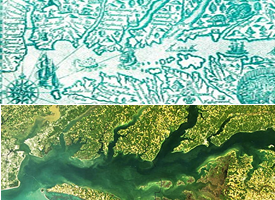 VIMS researchers use these tools—evermore accurate due to the advent of remote-sensing technologies such as LIDAR—for everything from fish-monitoring surveys to computer modeling of coastal flooding.
Viewing of the Voorhees map and charts is possible during guided tours of the VIMS campus and our annual Marine Science Day open house. Those unable to visit our campus in person can view the maps in a digital form below.