

Dredge Survey Methods
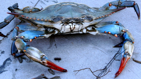 Callinectes sapidus The Bay-wide Winter Dredge Survey determines the status of the blue crab population in Chesapeake Bay. David Malmquist
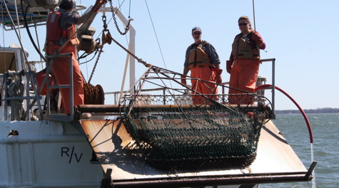 VIMS Dredge Survey team Members of the VIMS Dredge Survey team in action. From L: Captain Durand Ward, Mike Seebo, and Kathleen Knick prepare to deploy the crab dredge from the R/V {em}Bay Eagle{/em} at a site in the York River. David Malmquist
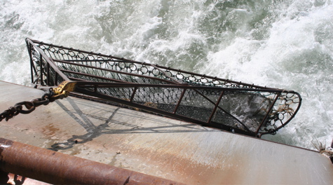 Cleaning the Dredge The survey team drags the crab dredge through the water to dislodge mud before it is brought on deck for sorting. David Malmquist
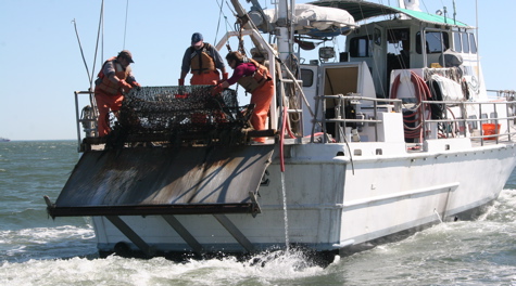 Dredge Retreival Captain Durand Ward and Kathleen Knick empty the crab dredge onto the deck of the R/V {em}Bay Eagle{/em} for processing as Mike Seebo watches for crabs. David Malmquist
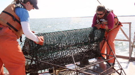 Emptying the Dredge Alison Smith and Kathleen Knick dump a dredge sample from a sandy site in the York River onto the deck during the Blue Crab Winter Dredge Survey. David Malmquist
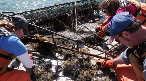 Sorting the Catch Alison Smith, Mike Seebo, and Kathleen Knick carefully sort through hydroids and other dredged materials from a York River site in search of blue crabs. David Malmquist
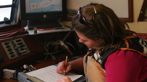 Recording Data Kathleen Knick records survey data aboard the R/V {em}Bay Eagle{/em} during a dredge tow. David Malmquist
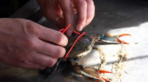 Crab Tagging A VIMS researcher tags a mature female blue crab collected during the Winter Dredge Survey. Recapture of tagged crabs provides data about crab movement, survival, and effectiveness of Virginia's blue-crab spawning sanctuary. David Malmquist
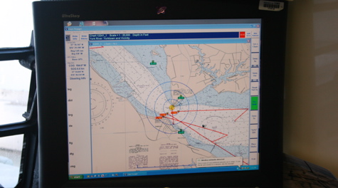 Navigation The survey uses a crab dredge to sample blue crabs at 1,500 randomly selected sites throughout Chesapeake Bay between November and March. By sampling during winter when blue crabs are buried in the mud and stationary, scientists can develop estimates of the number of crabs present in the Bay. Here's a computer map of three dredge paths near the mouth of the York River. David Malmquist
Sampling Design
Survey crews use crab dredges to sample blue crabs at 1,500 sites throughout Chesapeake Bay between November and March. The sites are roughly divided between 750 stations in the Virginia and Maryland portions of Chesapeake Bay.
By sampling during winter when blue crabs are buried in the mud and stationary, scientists can develop accurate estimates of the number of crabs present in the Bay. Estimates of abundance are developed separately for young-of-the-year crabs, mature female crabs, and adult male crabs. Together, these groups will produce the next generation of crabs.
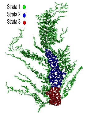 Sampling sites are divided into 3 separate "strata" or zones:
- Upper Bay and rivers,
- Middle Bay, and
- Lower Bay.
Zone 1 represents mostly shallow waters with low salinity (0 –10 ppt), where the winter population is dominated by young-of-year crabs and adult males. Zone 3 has higher levels of salinity (25–35 ppt), deeper water, and is inhabited primarily by mature females in winter. Zone 2 is an intermediate area. The number of sites sampled in each zone is proportional to the zone’s area.
Station locations are selected randomly to ensure that survey results are unbiased and statistically significant. Stations are located in waters deeper than 1.5 meters (m), as shallower areas are not accessible to survey vessels.
Details of the survey’s methodology and history are available here and in:
Sharov, A.F.; J.H Vølstad; G.R. Davis; B.K. Davis; R.N. Lipcius; M.M. Montane, 2003. Abundance and exploitation rate of the blue crab (Callinectes sapidus) in Chesapeake Bay. Bulletin of Marine Science 72(2): 543-565.
Field Methods
The VIMS winter blue crab dredge survey is conducted from the research vessel Bay Eagle, which is outfitted with a dredge platform, commercial winch, and chain. At each station, the survey crew tows a 6-foot wide (1.83 meters) Virginia crab dredge along the bottom for one minute at a speed of 3 knots. The dredge liner is composed of galvanized poultry wire, nylon, or polyethylene mesh. The dredge liner, with a mesh size of 1.3 cm, retains crabs with a carapace width larger than 15 mm. It occasionally catches smaller crabs.
The average distance towed is approximately 115 meters. Towing distance is determined by reading the latitude and longitude from a GPS unit at the start and end of each haul; the area swept (typically around 210 m2) is estimated by multiplying the towing distance by the dredge width. Depth at the start and end of each haul, water temperature, and salinity are recorded at each station.
Following each tow, dredge contents are released on deck, where survey crews separate crabs from by-catch, measure crab size, and determine each crab’s sex and stage of maturity. All crabs in the catch are measured to the nearest millimeter across the carapace and weighed to the nearest 0.1 gram. The survey crew also records habitat type, depth, sediment type, and numbers and species of by-catch. After they are measured and weighed, the crabs are returned to the water.