

VIMS scientists quantify Isabel's impacts
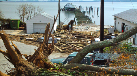 Ferry Pier Aftermath The VIMS Ferry Pier following Hurricane Isabel in September 2003.
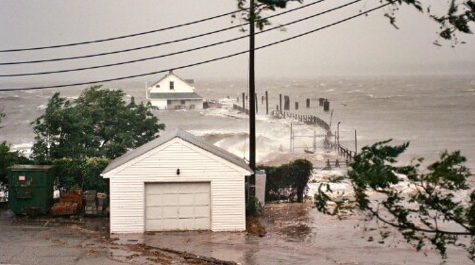 During the Storm The VIMS shoreline during Hurricane Isabel.
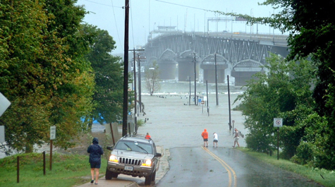 Gloucester Point Flooding Gloucester Point and the VIMS Boat Basin during Hurricane Isabel.
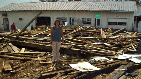 Debris VIMS professor Deborah Steinberg views the remains of the VIMS Ferry Pier, which were washed into the parking lot of the Customer Service Center during Hurricane Isabel.
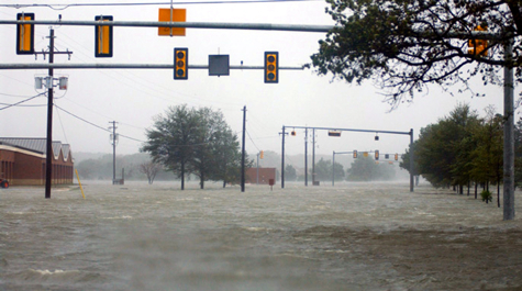 Langley Air Force Base Flood waters from Hurricane Isabel rendered one of the main streets on Langley Air Force Base virtually impassable. (U.S. Air Force photo by Tech. Sgt. Ben Bloker)
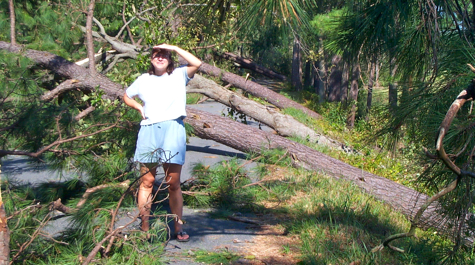 Felled Trees Hurricane Isabel downed trees across tidewater Virginia and the mid-Atlantic.
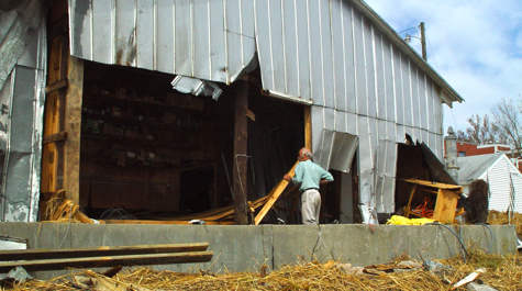 Clean-Up Monty Montigny cleans up the VIMS workshop following Hurricane Isabel.
As Hurricane Isabel approached Hampton Roads, VIMS Dean and Director Don Wright was busy in his administrative role, helping Institute staff move vulnerable scientific equipment out of harm's way. But as a scientist, he couldn't resist placing one instrument directly in the storm's path.
That instrument, an Acoustic Doppler Current Profiler, or ADCP, has helped provide a unique quantitative record of the hurricane's impact on lower Chesapeake Bay and the Gloucester Point shoreline. Data from the ADCP show that Isabel created a 7-foot storm tide topped by 6-foot waves. At the height of the storm, wave crests were passing over the instrument once every 5 seconds , and the storm was forcing the entire depth of the York River upstream at a rate of 2 knots.
Isabel's storm-surge and waves combined to destroy all three of VIMS' research piers (see photos and video), including the pumphouses and lines that supply running seawater to Institute scientists. Waves, storm-surge flooding, and fallen trees also claimed 18,000 sq ft of workspace and displaced 34 scientific and support personnel on the waterfront campus. Particularly hard hit were research programs involving blue crabs, cobia, and food-web studies.
Wright notes that Isabel's large size compounded its impacts. "Because Isabel was so large, its winds, waves, and surge affected the Bay for an abnormally long time." The ADCP showed that storm conditions persisted in the Bay for nearly 12 hours.
Wright and colleagues anchored the ADCP in 28 feet of water several hundred yards seaward of the VIMS campus, using long augers to secure the instrument to the muddy floor of the Bay. The instrument showed that wave-driven currents were strong enough to mobilize bottom sediments even at this depth, increasing water turbidity by a factor of two to three compared to fair-weather conditions.
The ADCP works by emitting sound waves that reflect off waterborne particles. By recording and analyzing these reflected waves, the instrument can measure the average current velocity in every 25-cm layer between the sensor and the water surface. It also measures turbulence, and the concentration of suspended particles.
Weather data provided by instruments atop VIMS' Byrd Hall show that maximum sustained winds on the campus reached 65 mph, with 90-mph gusts. The barometer bottomed out at 29.2 inches, with a rainfall accumulation of about 2.2 inches.